Throwback Thursday: 100 Sites for 100 Years: A Chicago Wildernewss Land Management Research Program
This post was originally posted in our January 2009 newsletter.
by Lauren Umek and Liam Heneghan, Institute for Nature and Culture, DePaul University
Despite the recognized centrality of ecological knowledge to restoration practice, there is sometimes an unproductive disconnect between the work of restoration practitioners and the work of researchers in this field. This disconnect has some potentially grave consequences for both. Though practitioners can often report on gratifying progress, they are frequently perplexed by unexpected outcomes. For example, noxious invasive species may persist despite repeated removal efforts and the native communities may fail to flourish despite repeated plantings. On the other hand, researchers often pursue more esoteric issues at the expense of applied research on the efficacy of practice, and on many occasions design projects on spatial and temporal scales that do not seem relevant to many restoration practitioners.
Chicago Wilderness (CW) is a regional biodiversity consortium of over 230 institutional members who collectively manage more than 1416 km2 of protected natural areas. CW coalition has been translating its research agenda into a long- term research program in the past two years. The Chicago Wilderness Research Agenda identifies critical gaps in scientific and management knowledge that must be closed over the next decade in order for the CW coalition to move toward realizing its vision of increasing the number of accessible, interconnected, restored, diverse, and healthy ecosystems in the greater Chicago metropolitan area. The final version of the Chicago Wilderness Research Agenda will be published in the coming year. With funding primarily coming from the Gaylord and Dorothy Donnelley Foundation, the Chicago Wilderness Research Program (CWRP) developing from the agenda is a multi-faceted one in which several counties in the Chicago Wilderness region are collaborating with us to create a system of 100 long-term research sites (prairies, woodlands and savannas), each with a core area of 0.01 km2 (1 ha), available for assessment and monitoring of ecological management efforts. The research sites are intended to serve the needs of the CW coalition members for decades to come. By bringing together managers, researchers, and where appropriate, restoration volunteers, the research program should establish a long-term collaboration between all constituencies needed for successful ecological restoration.

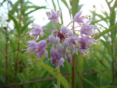
Nodding Wild Onion (Allium cernuum), one of the many beautiful prairie plants found in the CW region
These sites include woodland, savanna and prairie habitats, and have been selected along gradients of management effort, from those that are highly degraded, usually due to impacts of invasive species, to mature restoration sites that have been managed for 20 or more years. We have also included sites that represent the “highest quality/pristine” habitats in the region as well as some sites of particular interest to individual counties. This network of sites is the core of CWRP. It will be used to evaluate the effectiveness of biodiversity management practices and allow us to validate, improve, and invent the most effective restoration practices for the Chicago Wilderness region.

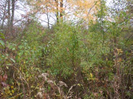
Degraded woodland site in Lake County, IL with various introduced species that are often the focus of management
Site selection in four Illinois counties (McHenry, Lake, DuPage, and Cook) will be completed in 2009. Data layers developed based upon site visits and consultations with managers are being incorporated into a Geographical Information System (GIS) along with all pre-existing data from each site. In the upcoming growing season, we will begin measuring a range of ecological criteria, or response variables, to serve as indicators of management success. These variables currently include plant species diversity, relative cover, presence of representative ground-active arthropods, and key ecosystem processes (decomposition rates, major soil nutrient pools, and rates of nutrient cycling). The methods we will use for ecosystem monitoring will be those of the National Science Foundation’s Long-Term Ecological Research (LTER) sites and of the Illinois Natural Areas Inventory. The use of similar methods will allow us to compare sites in CWRP with other sites throughout the region. This data will not only provide a comprehensive baseline that can be referenced for decades (perhaps even centuries), but will also allow us to develop regionally specific hypotheses about the success of different management techniques.

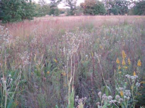
A mature prairie restoration site in Lake County, IL with a fairly high diversity of plants
This program is currently funded for the next three years, though the work will continue well beyond that time frame. One of the goals of the project is to stimulate an even greater interest by regional researchers in local applied conservation issues. Following the development of the comprehensive suite of baseline data and an accessible database, researchers throughout the region will be able to select from a representative range of habitat and management conditions and may contextualize their work within the context of basic ecological and land management data and in the broader context of regional ecological restoration and conservation.
