SER Mid-Atlantic will provide a showcase of up to four restoration sites (time allotted) for a Friday afternoon excursion. A box lunch and round trip shuttle service to the sites will be provided. Please wear appropriate field gear, bring bug spray and sunscreen, and bring plenty of water. The field trips will be a 4- to 5-hour event. A description of the sites are provided below.
Site 1: Elks Camp Bacon Ridge Branch Stream Restoration, Maryland Department of Transportation, State Highway Administration
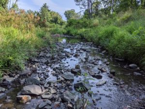
Nestled in 140 wooded acres near Annapolis, MD, Camp Barrett is a youth camp designed to help young people of all backgrounds to grow and develop by experiencing outdoor adventure and fun. Operated by the Elks Association of Maryland, Delaware, and the District of Columbia, the camp features multiple recreational fields and facilities, a swimming pool, hiking trails, and a running stream known as Bacon Ridge Branch. Over time, Bacon Ridge Branch suffered sedimentation and erosion as a result of regional deforestation and agricultural land use practices. Severely incised, with little in-stream habitat and no connection to its floodplain, the stream had become so degraded it blew out a culvert crossing on camp property. The restoration of Bacon Ridge presented an ideal opportunity for the Maryland State Highway Administration to initiate–through a full-service delivery contract with mitigation banking company Greenvest–a project that would yield benefits for the community while helping the agency achieve its TMDL goals. Teamed together, Greenvest and Biohabitats led the restoration of more than three miles of Bacon Ridge. The project, which had to be designed and fully constructed within an accelerated schedule of two years, also involved the restoration of two smaller, headwater tributaries. The restoration approach was to use on-site woody materials to raise the normal baseflow water surface to an elevation just below the floodplain in this Coastal Plain, wood-dominated stream system. Maximizing the use of downed trees and ash trees already vulnerable to the destructive emerald ash borer, the design involved the use of engineered log jams, naturally appearing wood structures that slow down the flow of water, help protect streambanks, and provide aquatic habitat. On the smaller, headwater tributary sites, wooden post-and-wattle structures placed in a repetitive fashion also help to modify flow in a way that augments existing headwater wetlands.
Site 2: Dead Run, Baltimore County Department of Environmental Protection and Sustainability
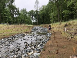
Dead Run is perennial stream located in the piedmont section of Baltimore County, Maryland. The restoration project was undertaken by Baltimore County Department of Environmental Protection and Sustainability as part of their watershed restoration efforts. The Dead Run project is located in the upper portion of the watershed and includes 2,050 linear feet of stream encompassing the mainstem and two tributaries located outside the Baltimore Beltway. The stream system was impaired due to vertical incision, mass wasting of vertical streambanks, and perched / disconnected floodplains. The design approach for the system was a hybrid of treatments that included floodplain reconnections along the tributaries, to restoration of the mainstem with the creation of new limited floodplain areas at lower elevations. The stream design is utilized a wide variety of bioengineering treatments, strategic streambank and floodplain grading, and in-stream structures to accomplish the project goals. An innovative offline stormwater pond was incorporated into the channel design that utilizes a splitter box at a stormdrain outfall to treat water quality within the BMP. The project was designed by WSP USA Inc with construction of the project by EQR, which was completed in early 2018. On the 2018 Memorial Day weekend the site was hit by a significant flash flood event, with over 12-inches of rain in less than 3 hours. Locally the flooding is known for the significant damages caused to Ellicott City, located less than 2 miles away. The restoration project weathered the flood extremely well, despite not having a growing season since completion, with the primary impact being the loss of the newly planted floodplain trees, the impact of which can be seen on the site today.
Site 3: Cape St. Claire Shoreline Stabilization, Cape St. Claire Community Association and Alliance for the Chesapeake Bay (IF TIME ALLOWS)
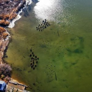
Located on the shore of the Magothy River, the waterfront community of Cape St. Claire had experienced historic and ongoing shoreline erosion. With the future impacts of climate change in mind, the community sought to replenish and protect its beachfront. Biohabitats was brought in to review all natural resources of the 1500-acre community’s landholdings and prioritize restoration opportunities. After conducting topographic and bathymetric surveys, assessing the site’s ecological and physical features, and analyzing shoreline recession and engineering, Biohabitats developed several conceptual, and ultimately final restoration designs for two high priority sites. At Site 1, at the confluence of the Magothy and Little Magothy Rivers and adjacent to the community park and beach, the design aimed to stop shoreline erosion and restore processes that would allow beach accretion. This was accomplished by coupling a headland breakwater with a small groin. At Site 2, 40 reef balls and large trees with intact roots will be placed near the outlet from a 4-acre still pond dominated by stormwater runoff. This element will create a complex shallow water environment ideal for fish and waterbirds. A battenboard face was constructed along an existing community pier to act as a groin to retain sand entrained in longshore drift to build the adjacent beach and reduce maintenance dredging of the marina on the other side of the pier. Both site designs integrated the removal and management of invasive Phragmites and the installation of native species.
Site 4: Spa Creek Headwaters Retrofit & Stream Restoration Design-Build, Spa Creek Conservancy
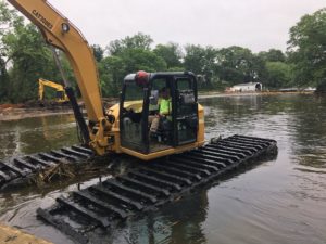
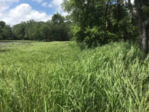
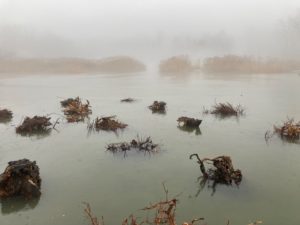
The headwaters of the Spa Creek watershed flow through Annapolis, MD and ultimately into the Chesapeake Bay at the mouth of the Severn River. The creek is a treasured natural and recreational resource, and it provides habitat for many species native to the Chesapeake Bay. In recent decades, however, development and population growth in the area have put pressure on Spa Creek’s headwaters, causing many of them to become eroded sluiceways through which stormwater swiftly carries sediments and pollutants downstream. To address these problems, the Spa Creek Conservancy, a volunteer organization dedicated to the stewardship of this important tributary, initiated restoration efforts in the watershed’s upper reaches. The project includes the restoration of 5,000 linear feet of stream, beginning at an outfall that had been lined with gabions years earlier and ending at a stand of Phragmites established on a sediment deposit formed by channel erosion and upland sediment transport into tidewater. Biohabitats, teamed with Meadville Land Service, implemented under this design-build contract a long-term, stable channel geometry with increase nutrient uptake and other water quality improvements and enhancements to aquatic, wetland, and riparian habitat. The design removed gabions, added fish passage through impassable road culverts, created step pools to slow flows, and raised the channel bed to reconnect the stream to its floodplain. The floodplain reconnection allows stormwater to rehydrate non-tidal wetlands. The design also incorporates the excavation of two acres of Phragmites and restoration of emergent tidal wetlands.


